Metro C: Historical heritage
Safeguarding and enhancing a heritage of humanity
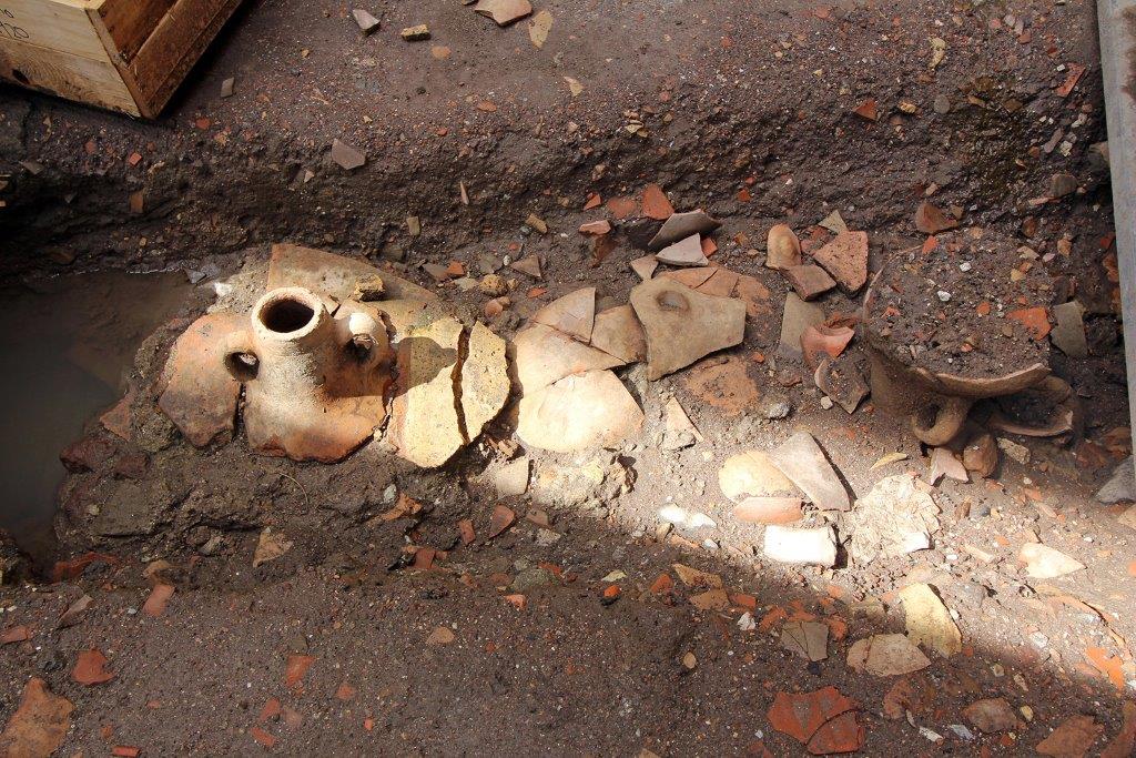
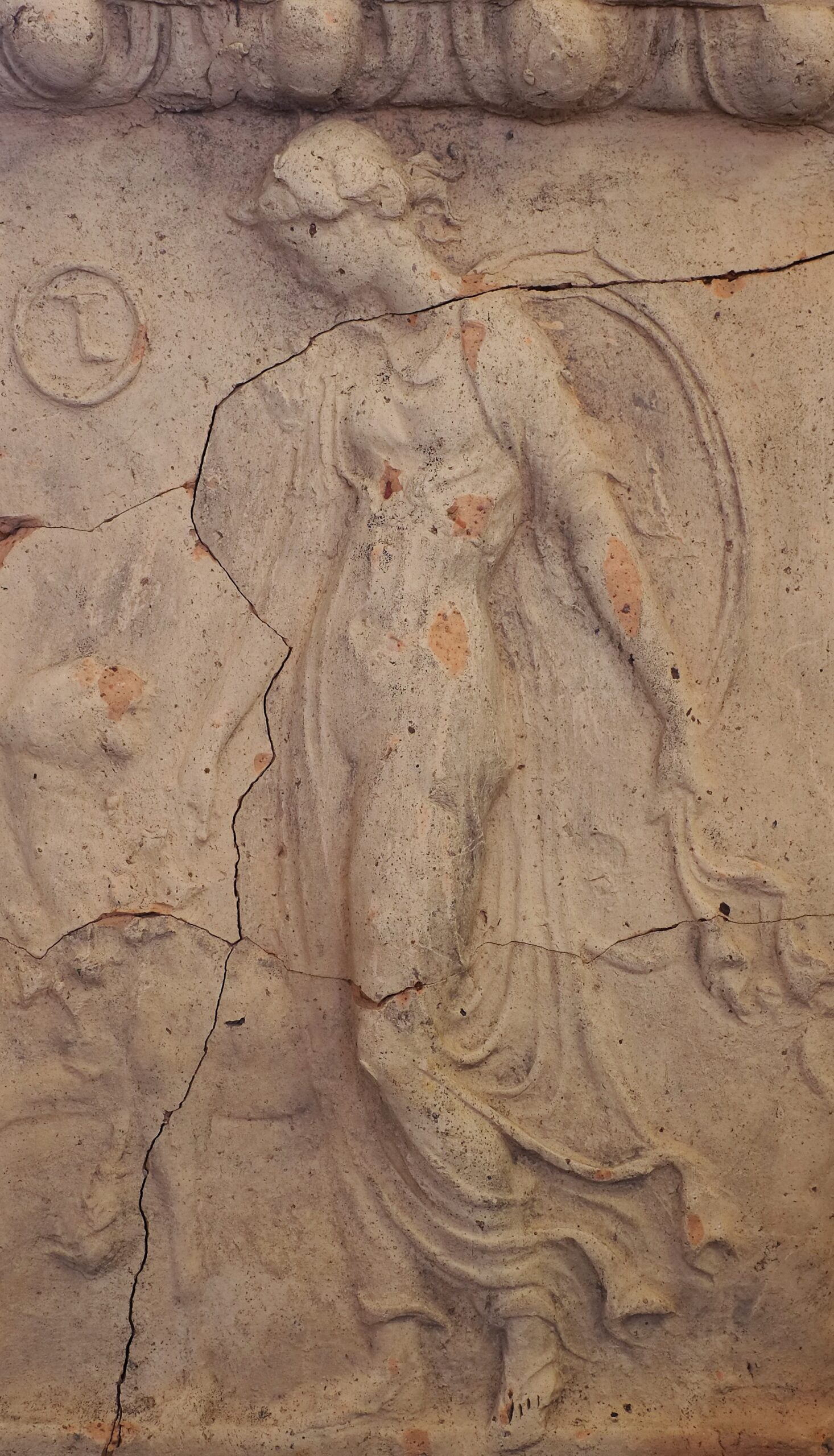
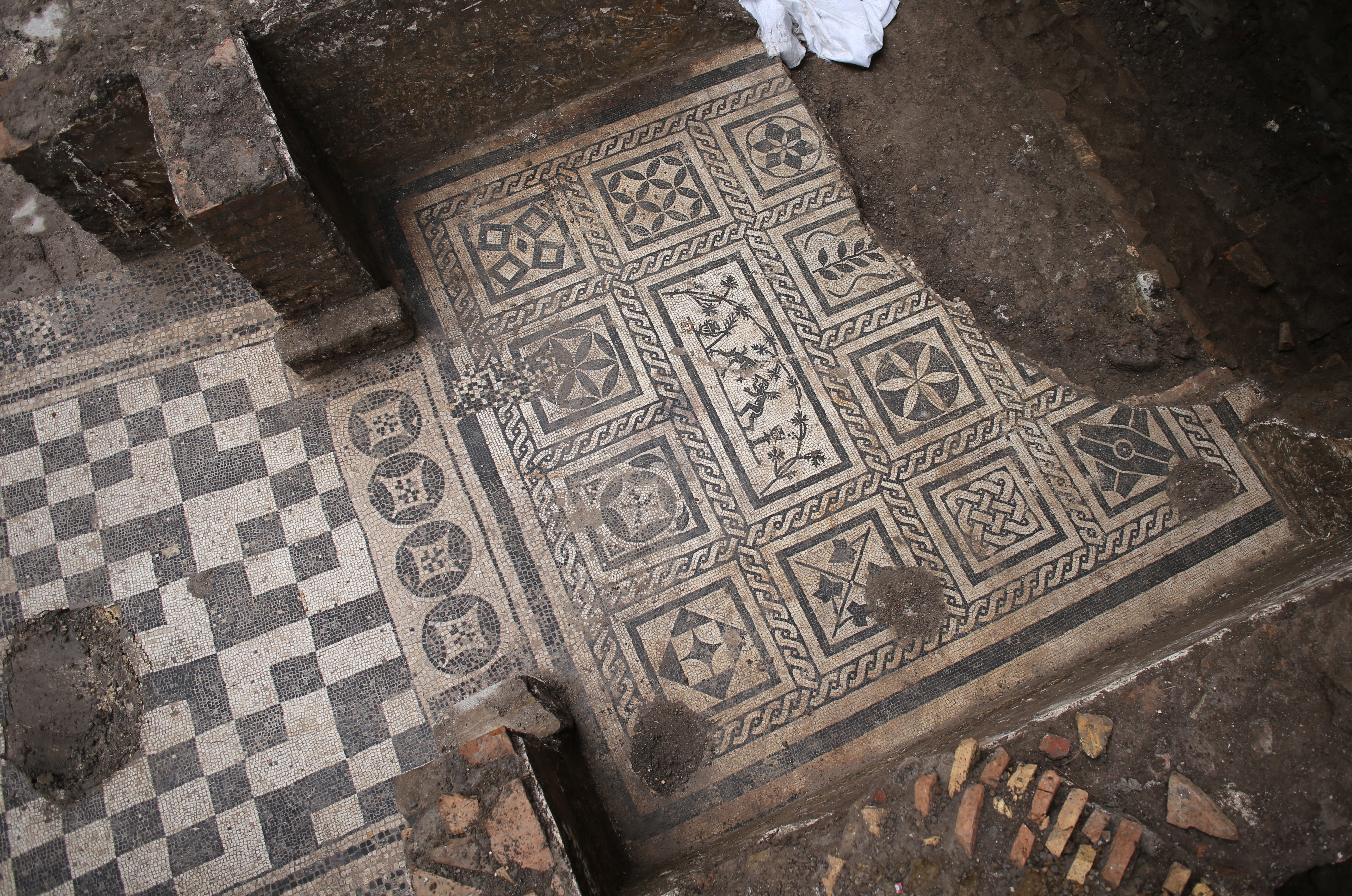
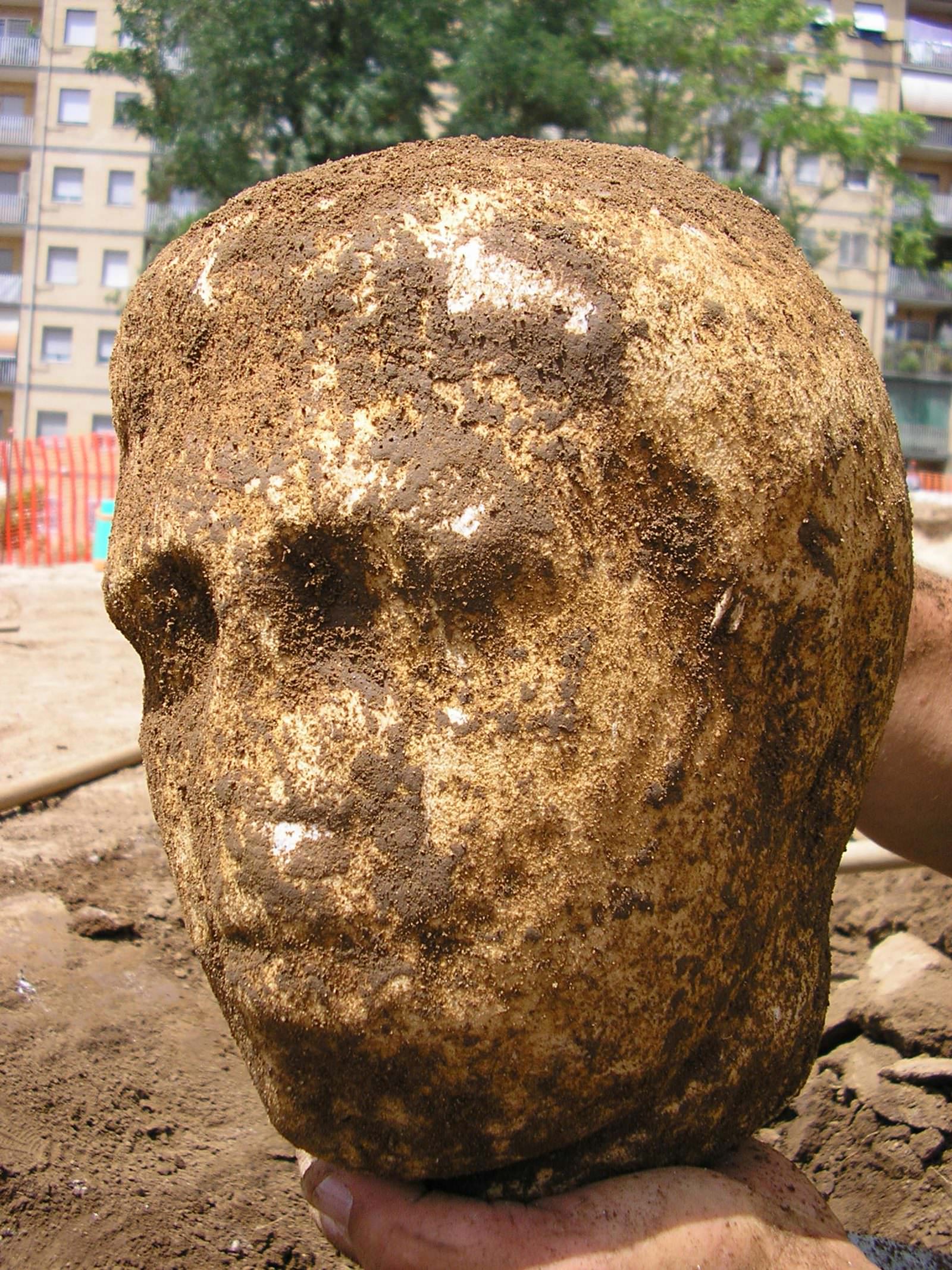
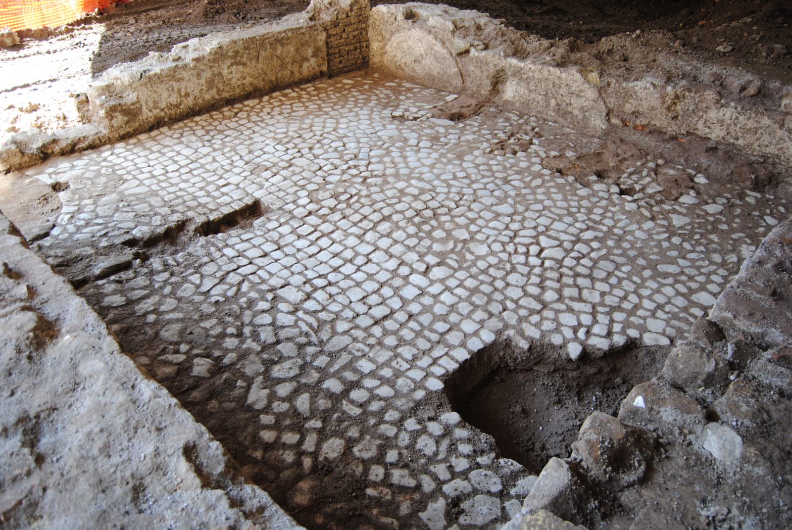
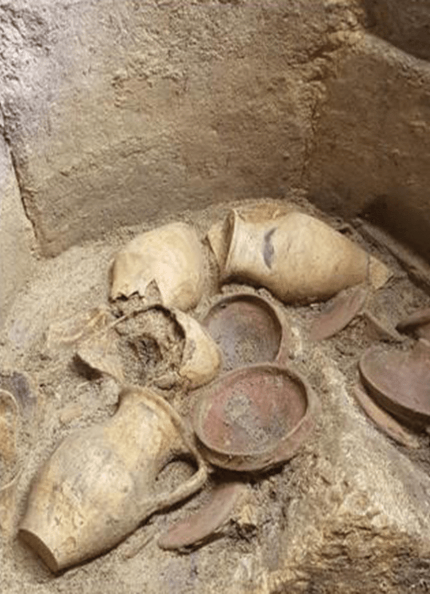
The Line C of the Rome metro does not only travel through urban space, but also through time. It indeed represents a unique opportunity for the growth of knowledge of Ancient Rome. This is because the archaeological excavations have allowed the discovery of ancient structures or parts of them, in excellent states of preservation.
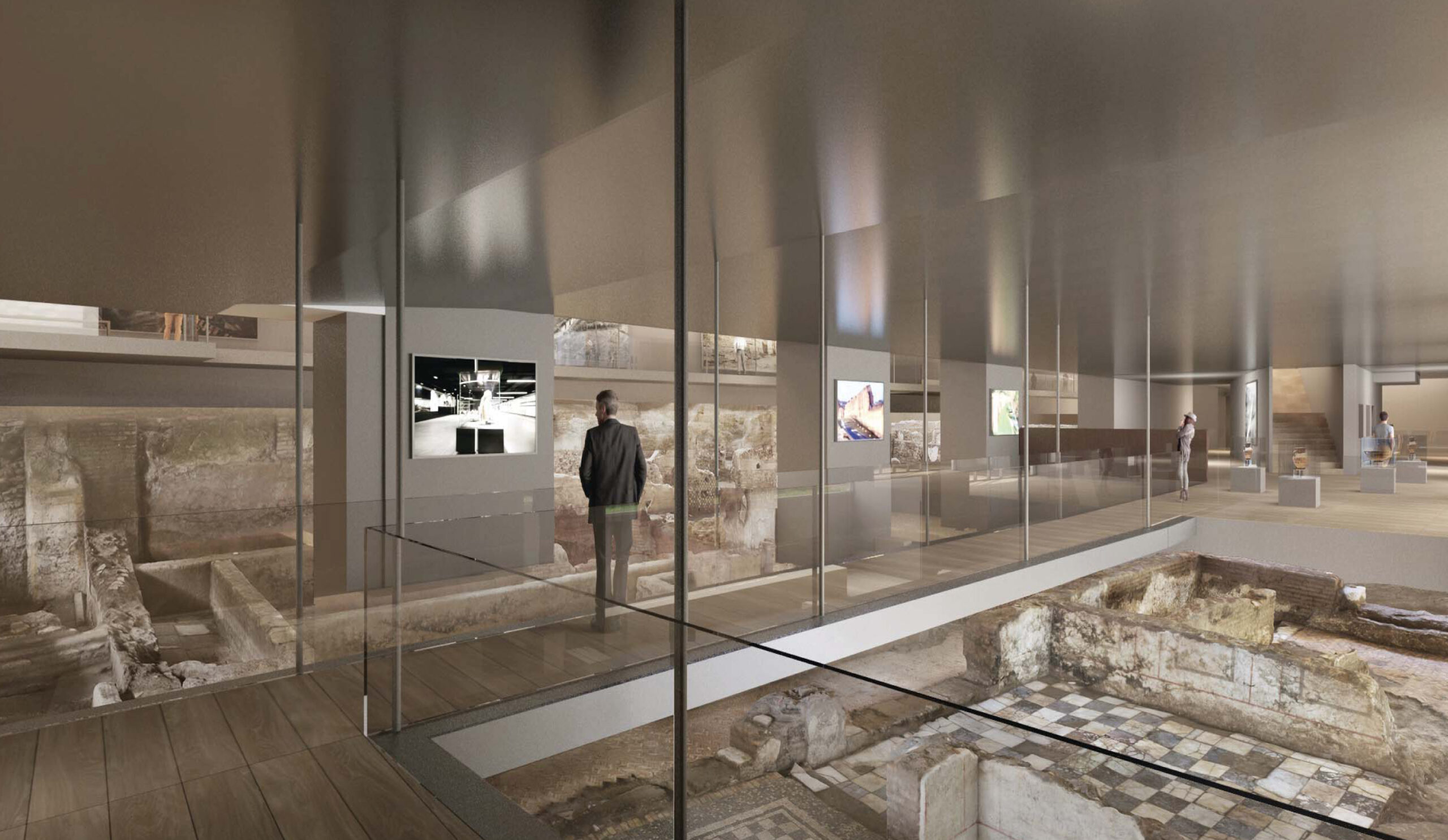
The findings have become the protagonists of a real enhancement of the past in the present era through museum exhibition projects within some stations, as in the case of the San Giovanni, Porta Metronia and Colosseo Fori Imperiali stations, and the future Venezia station.
The recovery of the past before the eyes of citizens
Line C aims to create a renewed iconography of the Capital, opening an underground window onto Ancient Rome. The uniqueness of the territory traversed, which stands out for its absolute historical and archaeological value, has indeed inspired a dedicated and specialized project methodology.
The high number of findings, combined with their historical relevance and their good state of preservation, led the Superintendence of Rome to prescribe the realisation of specific museum installations within the stations of San Giovanni, Porta Metronia, Colosseo – Fori Imperiali, and Venezia.
From the collaboration between the Municipality of Rome, the Client Roma Metropolitane, and the Ministry of Culture, Metro C S.c.p.A. has realised a vision of development that transforms the underground cultural heritage from a construction constraint to a strength to be amplified.
Innovation and collaboration for the safeguarding of our roots
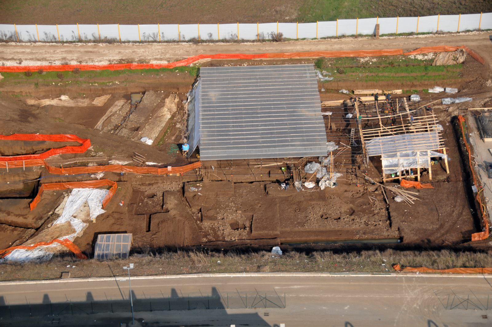
For the entire route from the terminus of Monte Compatri/Pantano to Piazzale Clodio/Mazzini, 585,000 cubic meters of excavation with archaeological methodology are planned.
From the collaboration between the General Contractor Metro C S.C.p.A., the Municipality of Rome, the Client Roma Metropolitane, and the Ministry of Culture, an articulated program of investigations has emerged that, under the Scientific Operational Direction of the Superintendence of Rome, has allowed not only identification of numerous finds, but also the updating of the archaeological maps in areas never before investigated.
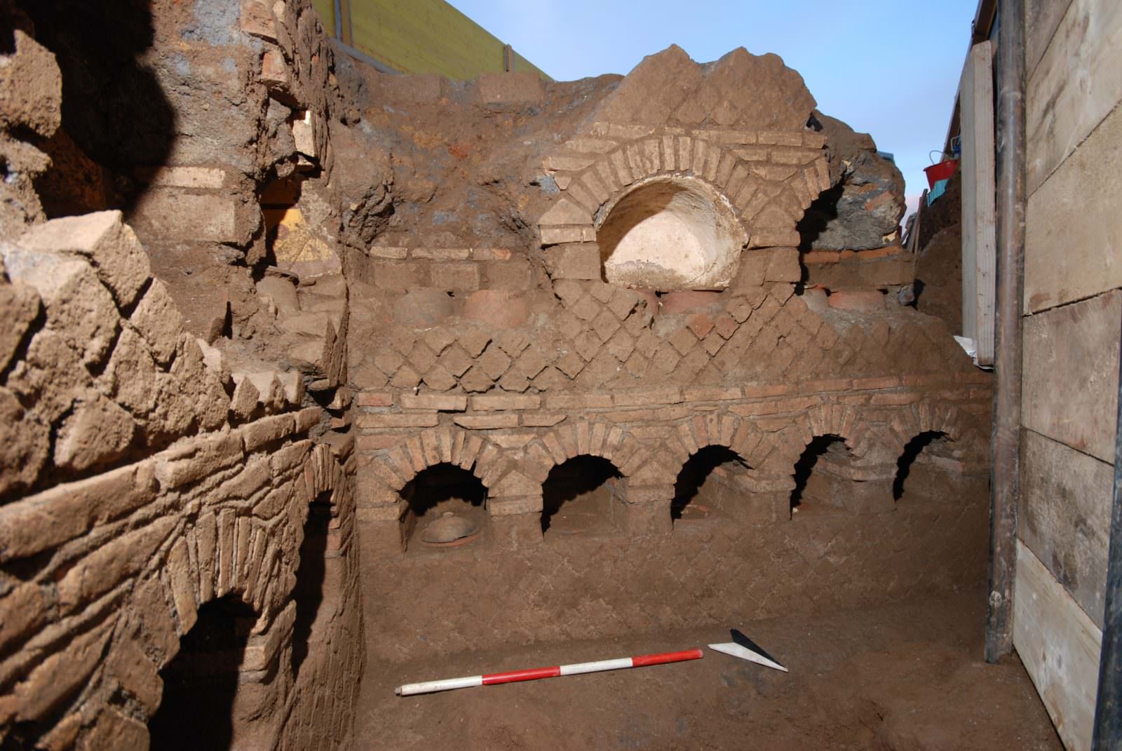
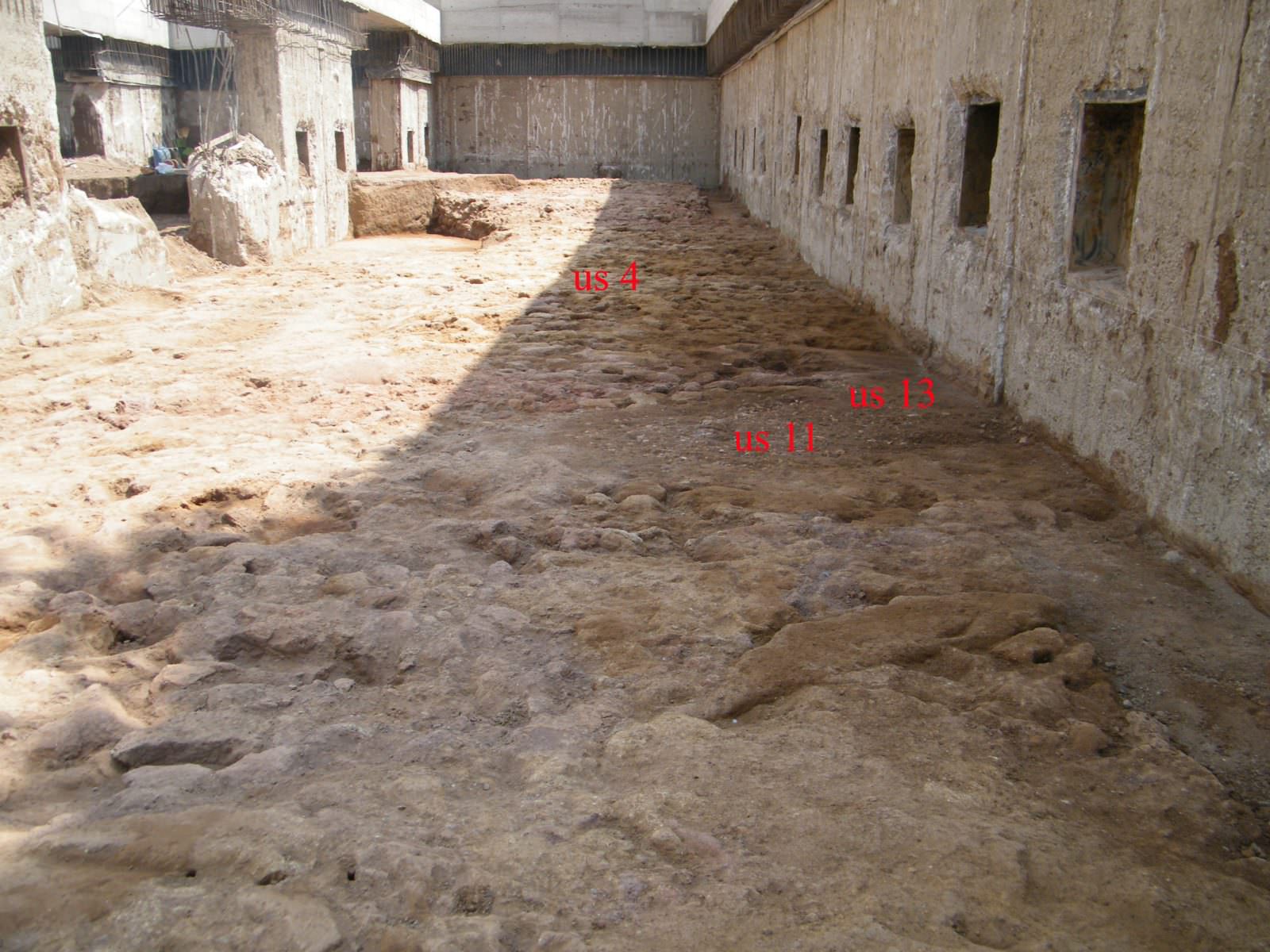
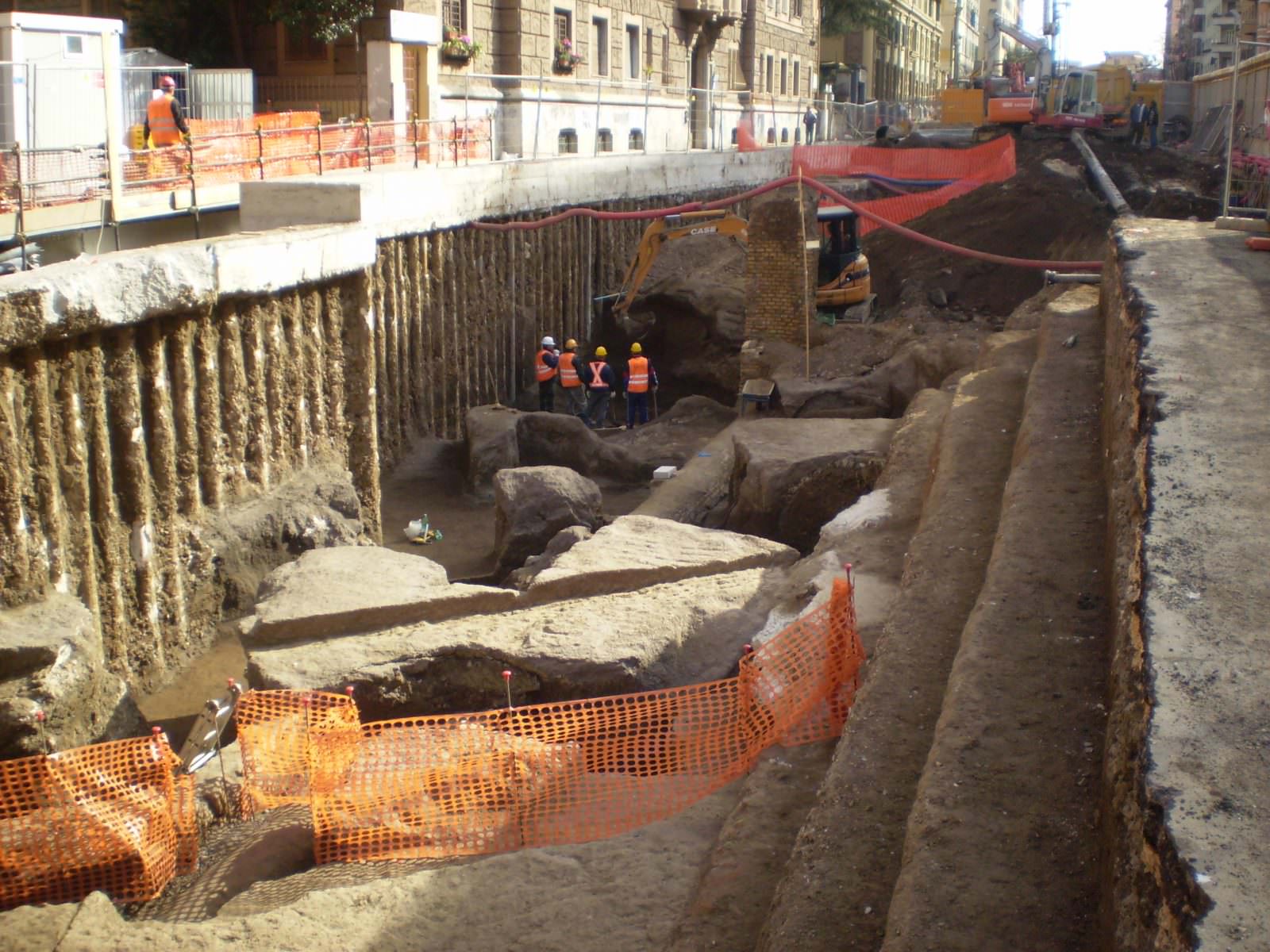
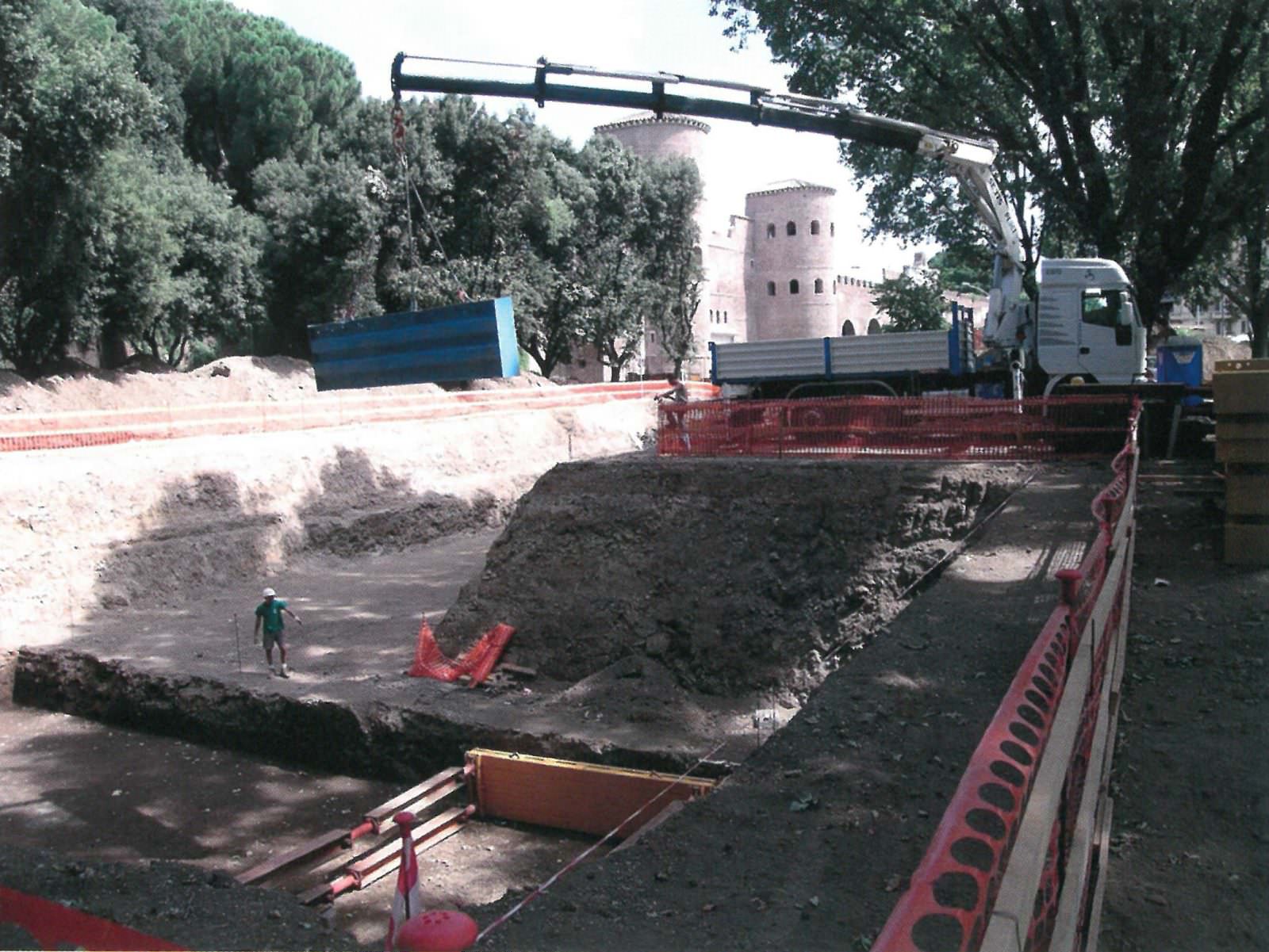
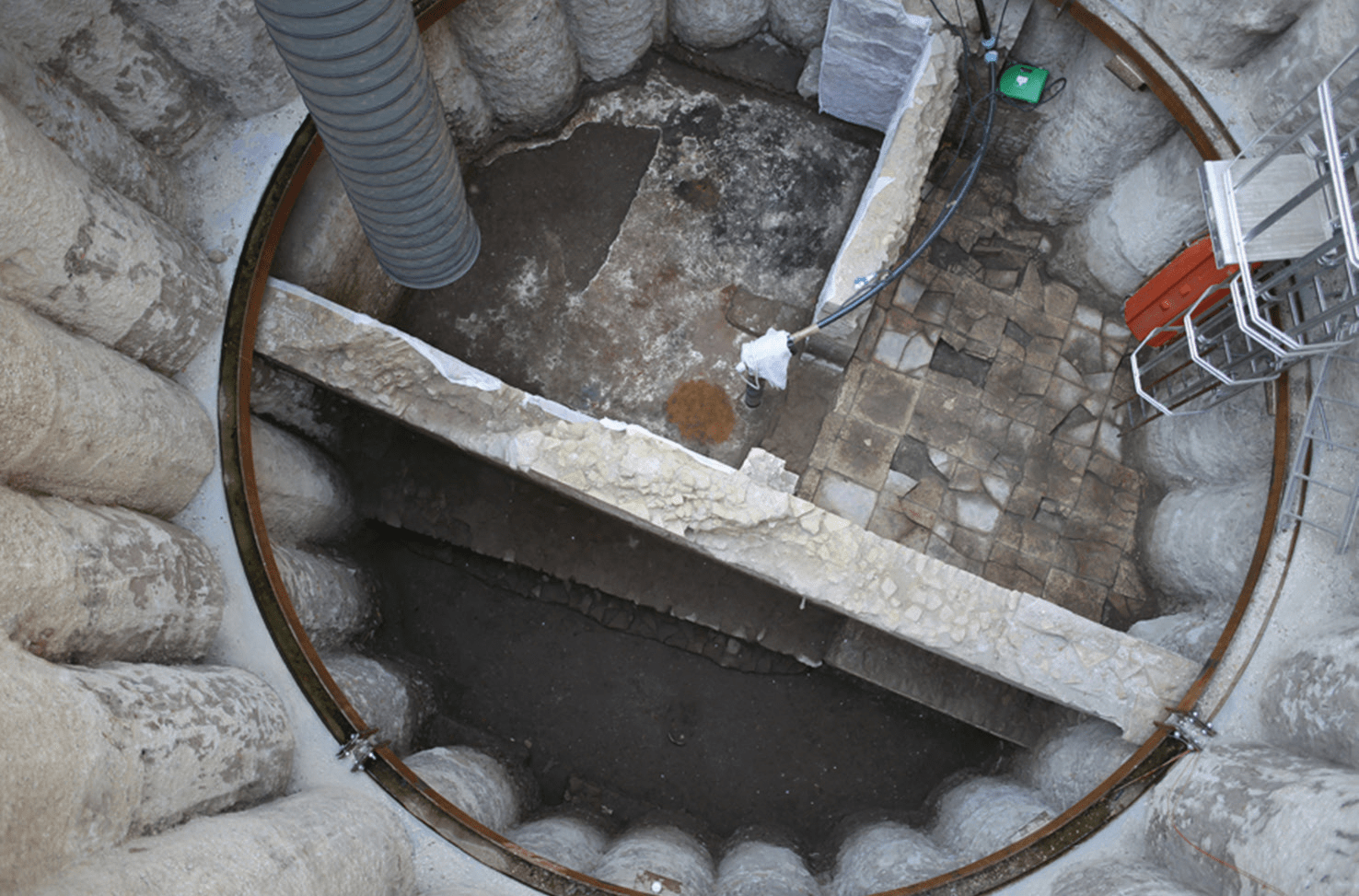
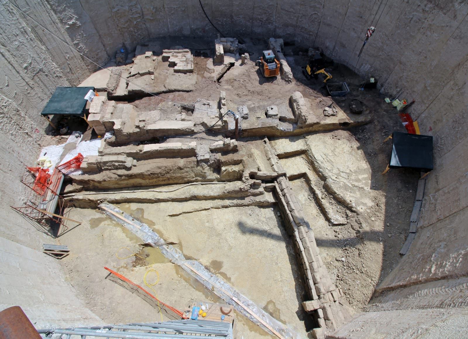
The construction of the stations and ventilation shafts required the removal of substantial volumes of buried archaeological deposits, representing a unique and unrepeatable opportunity to acquire new and important data also in areas archaeologically little known until that moment, especially due to the depth of the ancient stratigraphy, which, in some cases, reached 20 meters from the current street level.
The close and constant collaboration between Metro C S.C.p.A. and the Archaeological Superintendency of Rome, together with the guidelines of the Technical Scientific Committee for Archaeological Heritage, also led to the development, for the first time in Italy, of the so-called “Prontuario delle indagini archeologiche di seconda fase”. The Prontuario (a Handbook) is drawn up by the General Contractor in the definitive design phase, based on the results acquired with the first phase archaeological investigations, and defines for each site, in concert with the Archaeological Superintendency of Rome, the excavation methods to be implemented at different depths and the methods for the removal of finds.
To combine the need to carry out open-air archaeological excavations up to a depth of 18-20 meters with the need to limit the impact on the territories of the construction areas, a new excavation method called “archaeological top-down” was also developed, applied in particular to the San Giovanni station.
In the section now in operation, which runs from Monte Compatri/Pantano station to San Giovanni station, the work carried out has thus allowed, on the one hand, to update all the historical cartography, reconstructing the original morphology of portions of the territory, and on the other hand, to define absolutely compatible project solutions with the archaeological substrate.
Preventive archaeological investigations
The interferences with the archaeological layers mainly concern the realisation of the stations and ventilation shafts, as the tunnels always run below the archaeological level which usually settles around 10-12 meters from street level.
Since 2006, in addition to the investigation campaign conducted by the Municipality of Rome for the drafting of the preliminary project, the first phase preventive archaeological investigations for the sections T2 (Venezia – Clodio Mazzini), T3 (Colosseo – Fori Imperiali – San Giovanni excluded), T6 (Torrenova – Torre Spaccata) and T7 (Monte Compatri – Pantano – Torrenova) have begun, in preparation for the definitive design.
 OLYMPUS DIGITAL CAMERA
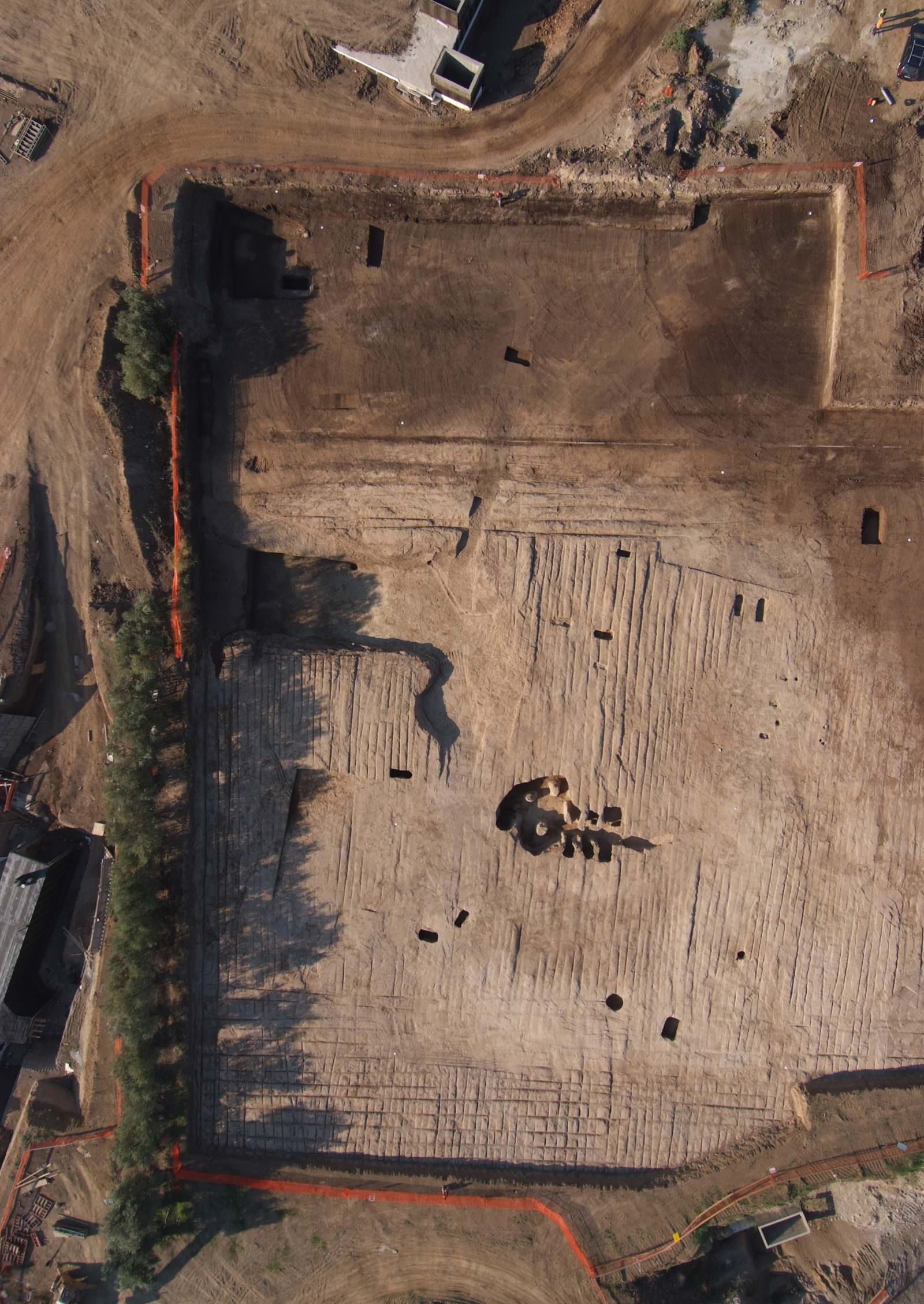
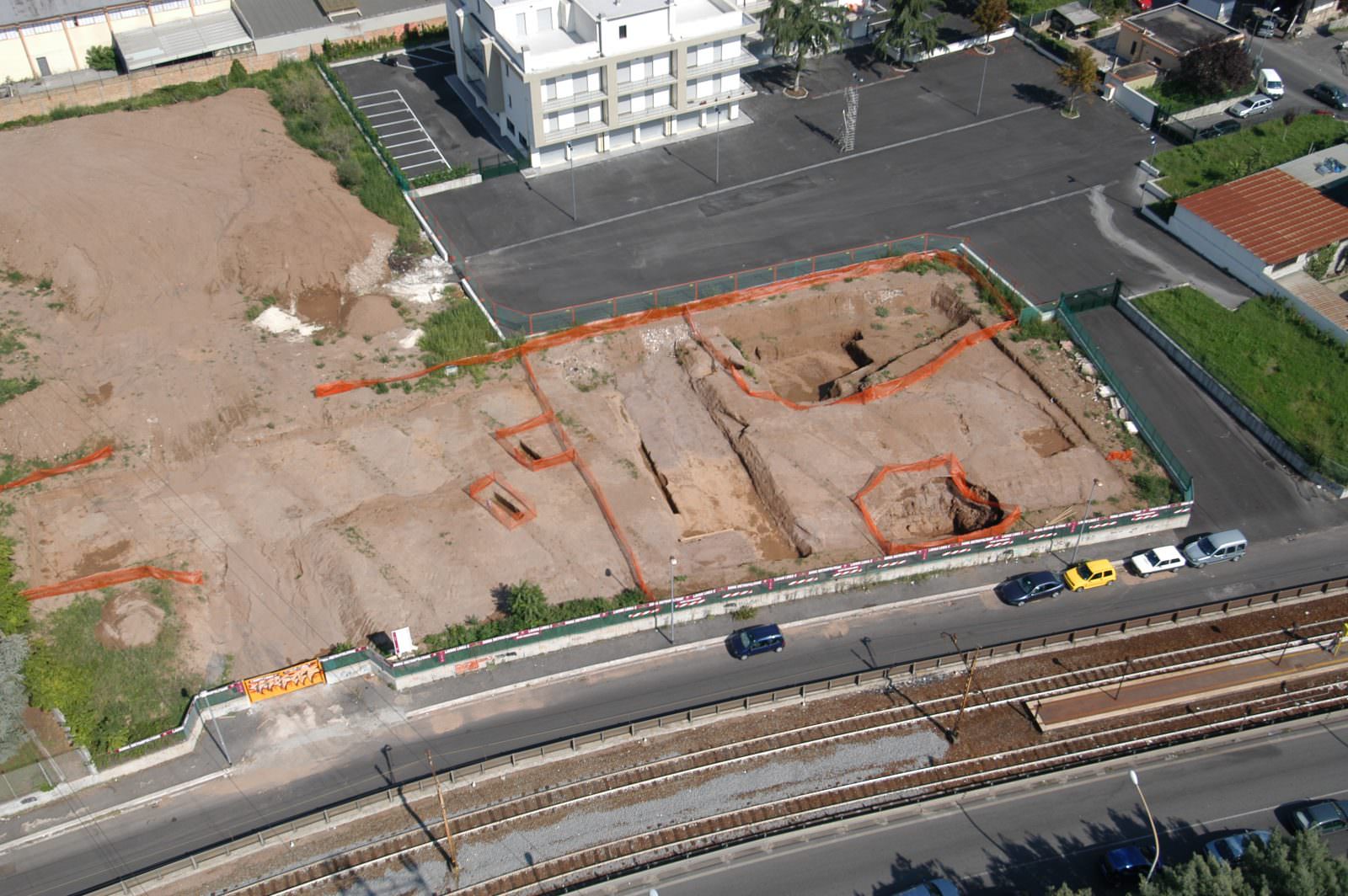
The area of the Historical Centre has seen the opening of construction sites in 22 archaeological sites involving the T2 and T3 sections (from Clodio Mazzini to San Giovanni excluded).
For the first section Monte Compatri/Pantano – San Giovanni alone, the second phase investigations have been completed, i.e. the integral excavation of the volume of land of archaeological interest, which have allowed the discovery of a considerable amount of finds. The activity carried out in the 29 archaeological sites investigated, based on excavations of sizes sufficient for the works to be carried out and not on point corings, has allowed to update the historical cartography and to define project solutions compatible with the archaeological substrate, as confirmed by the Superintendencies.
The interaction Line-Monuments
History in our present
Prior to the drafting of the definitive design of the line, a study of interaction Line-Monuments was also developed, entrusted to the most qualified operators in the sector. A multidisciplinary Technical Scientific Committee was also established, composed of the most authoritative experts in the European panorama, in the field of underground work design in urban environments.
The Line-Monuments interaction studies provided valuable technical and scientific support in defining the safeguarding interventions of the monuments and the related monitoring project, leading to the implementation of structural or geotechnical control interventions – temporary or definitive – for a series of monuments. The interaction analyses were developed over about 4 years, involving 13 monuments and 40 historical buildings.
A specific monitoring system, called “SDD platform”, was then custom implemented for Line C. The system is able to manage in real time the monitoring of the works (stations, shafts, and special works) and was designed to verify the deformation response of the ground and the structures under construction, as well as the monuments and historic buildings present in the area of intervention.
The monitoring is based on the concatenation of automation, remote measurement and their computerization and publication on WEB-GIS platform, in order to allow workers to access monitoring data through the web in times compatible with the management of any critical issues and, therefore, in such times as necessary, to be of support to the construction site and the designer.
Navigate the map to discover the archaeological sites

Parking area of the Monte Compatri/Pantano station
Within the context of this site, archaeological excavations have unearthed prehistoric tombs and ritual pits. Eneolithic necropolis.

The safeguarding interventions
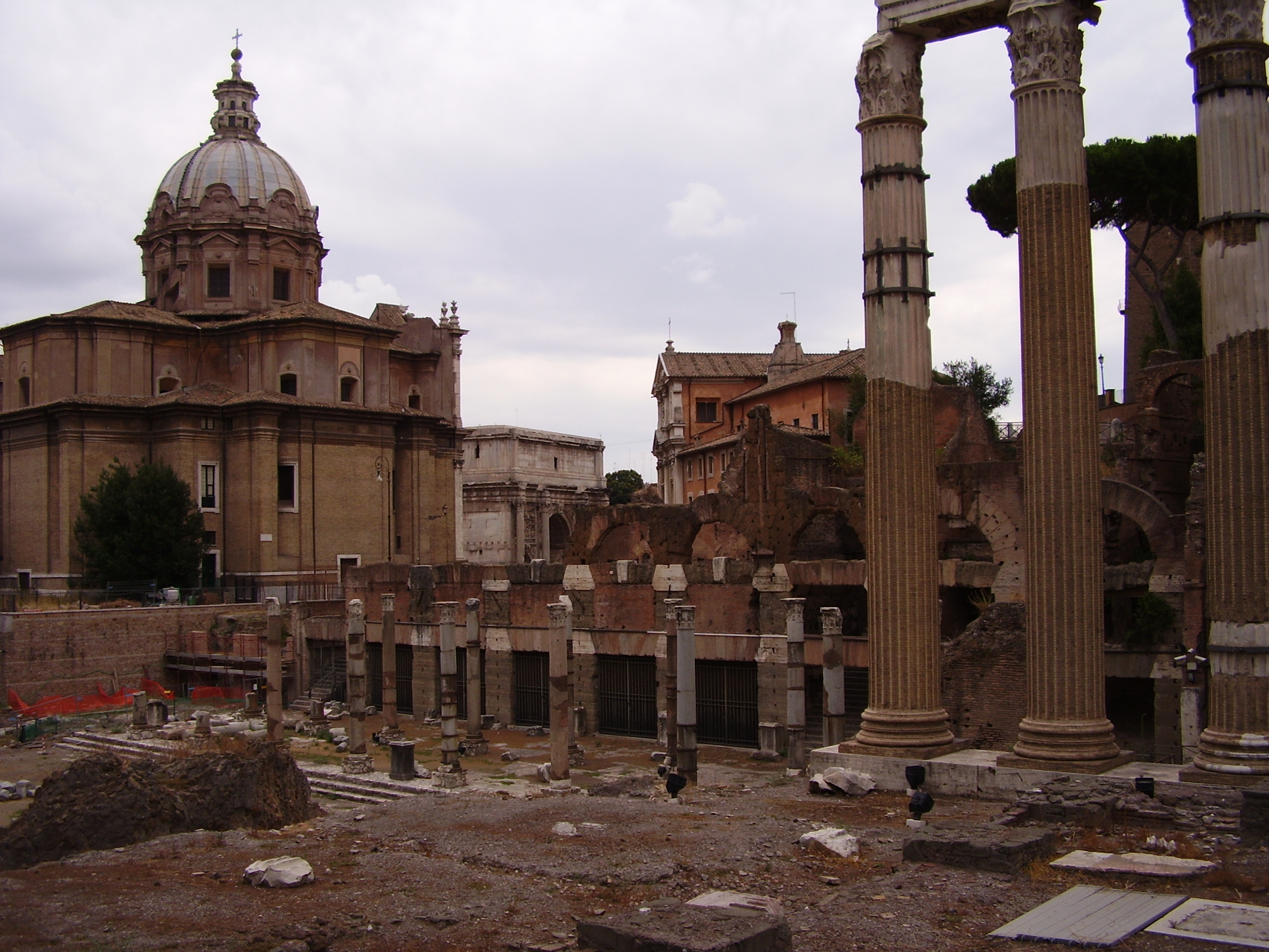
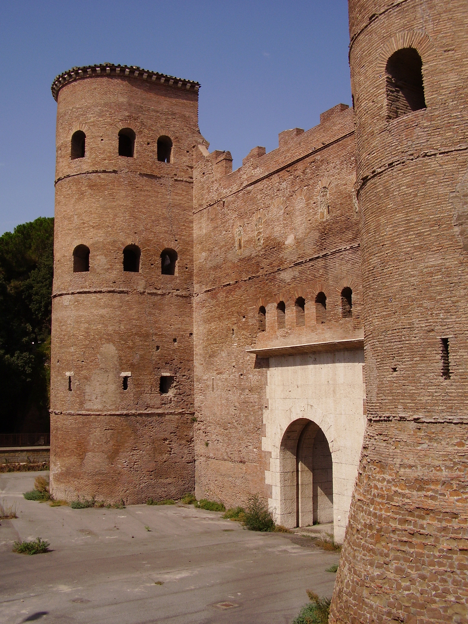
In the T3 section (from San Giovanni excluded to Colosseo -Fori Imperiali) the study of interaction Line – Monuments has led to the implementation of structural and/or geotechnical control interventions – temporary and/or definitive – for the following monuments:
- Aurelian Walls at Porta Asinaria: temporary shoring of the walls and construction of a bulkhead of piles to protect Porta Asinaria.
- Aurelian Walls at Porta Metronia: temporary shoring of the walls and geotechnical intervention to compensate for subsidence (Compensation grouting) during the passage of the TBM.
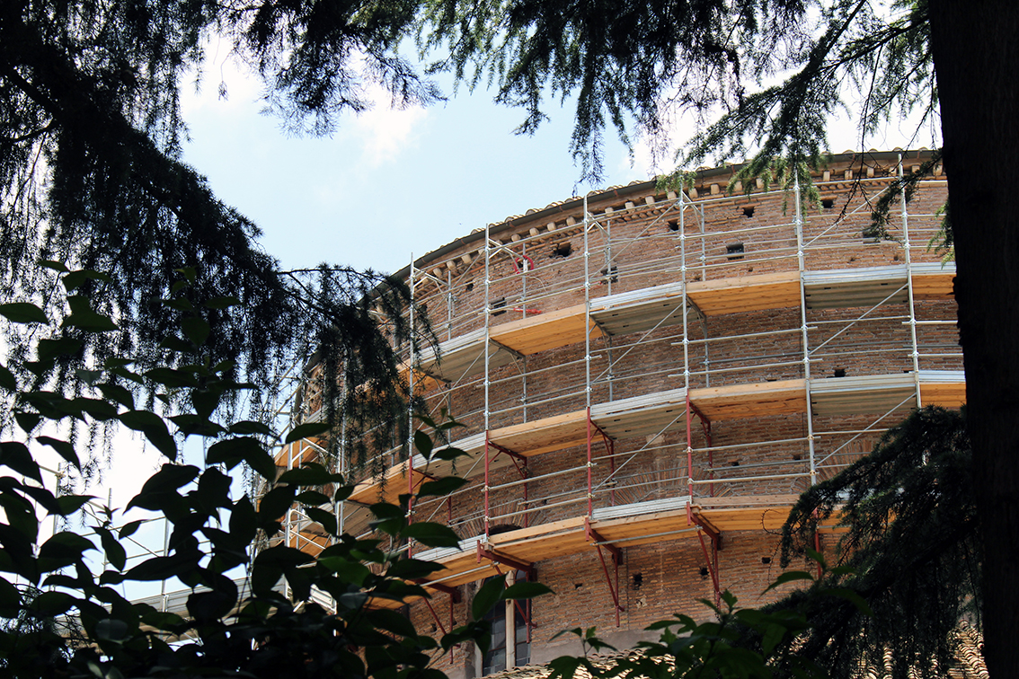
- Church of Santa Maria in Domnica: temporary internal and external shoring and interventions to safeguard the artistic heritage inside the church.
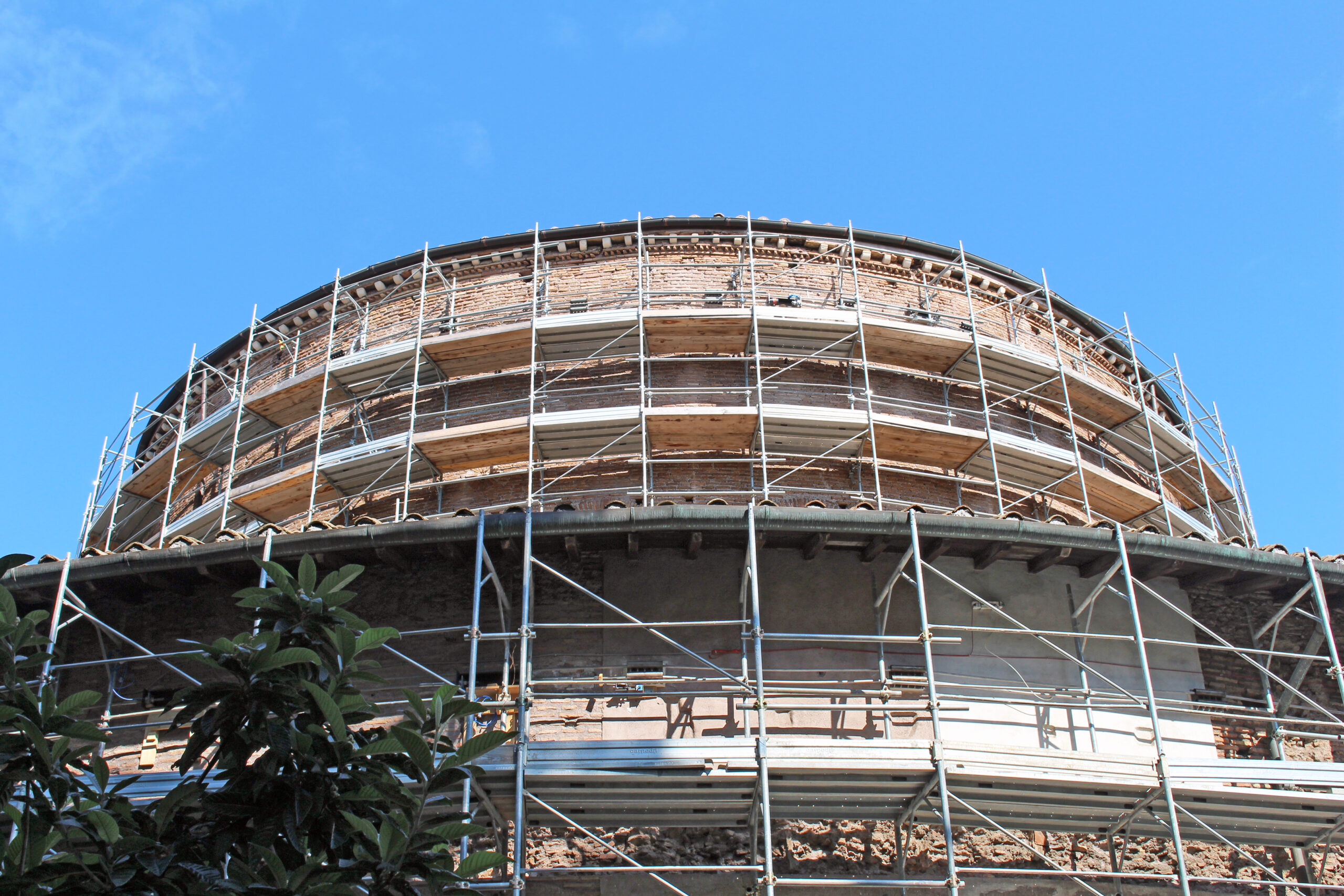
- Church of Santo Stefano Rotondo: shoring of the drum and interventions to safeguard the artistic heritage inside the church.
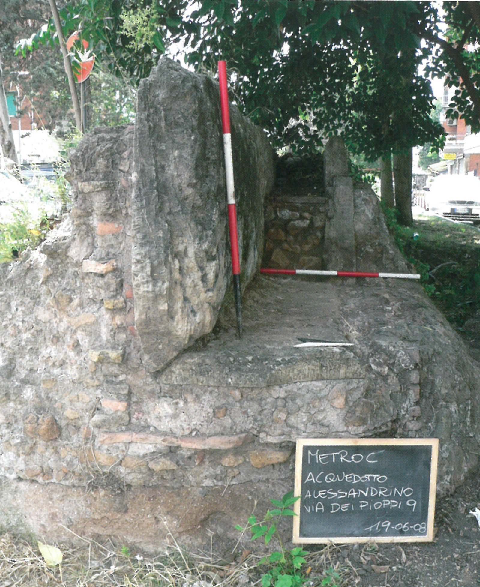
- Pillars of the Celimontano aqueduct: temporary shoring.
- Temple of Venus and Rome: temporary shoring.
- Basilica of Maxentius: temporary shoring of the external walls and definitive shoring with cables and bars.
- Colonnacce of the Forum of Nerva: temporary shoring.
All the monuments that fall within the subsidence basin of the works of Line C are under constant control by means of a wide instrumentation of vibrational, structural, geomatic, and geotechnical monitoring.
 OLYMPUS DIGITAL CAMERA
The monitoring plan in progress has envisaged an articulated control system to be carried out both on the surface and underground during the construction of the line tunnels, stations and all accessory works (shafts, tunnels, semi-mechanized excavations, connections and special works) by installing 28,706 topographic, structural, and geotechnical instruments, of which as many as 10,005 in correspondence with monuments. The system operates h24 through a complex system of control units that automatically acquire data and send alerts in real time to operators. As an example, 290 instruments were installed on the Colosseum.